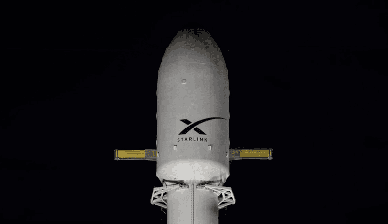
Falcon 9 Block 5 | Starlink Group 10-42 — what you saw in the sky & launch recap
A batch of 29 satellites for the Starlink mega-constellation - SpaceX's project for space-based Internet communication system.
Missed this one? Get alerted for the next launch you can see
Enter your ZIP or city and we’ll email you about a day before every launch that clears your horizon, with the direction to look.
Click the one confirmation email we send to activate. One-click unsubscribe.
For free area alerts, we store your email, chosen location, alert preferences and delivery history so we can send and manage your alerts. Privacy details.
Free email alert + a note if the date moves ✓ what you’re signing up for now
Pro a text when it’s a go and before liftoff (delivery times vary) · the weather at liftoff in the app · a minute-by-minute where-to-look plan · $19.99/yr or $4.99/mo
Caught this one in person? Sign up free and start your launch log and mark this one as seen →
Free · no account needed
Liftoff time
- Jul 9, 2026, 9:25 AM UTC
- Jul 9, 2026, 5:25 AM Eastern
- Jul 9, 2026, 2:25 AM Pacific
What you saw
If you spotted a moving light in the sky from Port Canaveral, FL · Titusville, FL · Merritt Island, FL or nearby, this launch is very likely what it was.
- Which way it headed: from Port Canaveral, FL it first appeared low in the north-northeast sky, then climbed toward the northeast as it flew downrange.
- How long it was visible: from Port Canaveral, FL, it rose into view about 5 seconds after liftoff and reached its highest point (roughly 34° above the horizon) around T+2m 35s; most viewers had it in sight for a few minutes.
- Twilight launch: Twilight launches are the best kind — sunlight catches the exhaust high above you, creating a glowing plume that can fan out across the sky.
This was a space-jellyfish launch
Falcon 9 Starlink Group 10-42 lifted off in dawn twilight, with the Sun about 13.3° below the horizon at the pad. Our geometry model graded the jellyfish chance high: the exhaust climbed into sunlight around T+4–5 min while the ground was still dark, which is the recipe for the glowing bell-and-tentacles cloud people photograph.
The grade is geometry, not a sighting report. Whether you saw the plume depended on clouds, your horizon and which direction you were facing.
What a space jellyfish is, and how we predict it → · Every upcoming launch graded for a jellyfish →
Spotted by our members
Caught it yourself? Sign in and log it — text sightings appear here right away; photos after a quick review.
Visibility map: how far away could you see it?
Each ring shows how far away Falcon 9 Block 5 was line-of-sight visible that many seconds into flight: about 89 miles by T+30s, 192 miles by T+60s, and roughly 305 miles by T+90s. City dots are colored by the expected view quality; the table below has the direction to look from each.
Which cities could see this launch?
Estimated visibility from major towns near US launch sites, assuming clear skies and an open horizon at the time of liftoff. The 10 most likely first:
| City | Visibility | Look toward | Distance to pad |
|---|---|---|---|
| Port Canaveral, FL | Excellent | north-northeast | 11 mi |
| Titusville, FL | Excellent | east-southeast | 15 mi |
| Merritt Island, FL | Excellent | north-northeast | 16 mi |
| Cocoa Beach, FL | Excellent | north | 17 mi |
| Mims, FL | Excellent | east-southeast | 17 mi |
| Rockledge, FL | Excellent | north-northeast | 18 mi |
| Satellite Beach, FL | Excellent | north | 26 mi |
| Indialantic, FL | Excellent | north | 33 mi |
| Melbourne, FL | Excellent | north | 33 mi |
| Palm Bay, FL | Excellent | north | 37 mi |
Show all 94 cities
| City | Visibility | Look toward | Distance to pad |
|---|---|---|---|
| New Smyrna Beach, FL | Excellent | south-southeast | 39 mi |
| Sanford, FL | Excellent | east-southeast | 45 mi |
| Orlando, FL | Excellent | east | 49 mi |
| Sebastian, FL | Excellent | north | 52 mi |
| Daytona Beach, FL | Excellent | south-southeast | 52 mi |
| Kissimmee, FL | Excellent | east-northeast | 54 mi |
| Vero Beach, FL | Excellent | north | 65 mi |
| Fort Pierce, FL | Excellent | north | 78 mi |
| Palm Coast, FL | Excellent | south-southeast | 80 mi |
| Port St. Lucie, FL | Excellent | north | 90 mi |
| Lakeland, FL | Excellent | east-northeast | 91 mi |
| St. Augustine, FL | Excellent | south-southeast | 102 mi |
| Tampa, FL | Excellent | east-northeast | 122 mi |
| Gainesville, FL | Excellent | southeast | 129 mi |
| West Palm Beach, FL | Excellent | north-northwest | 132 mi |
| Jacksonville, FL | Excellent | south-southeast | 138 mi |
| Fort Lauderdale, FL | Excellent | north | 171 mi |
| Brunswick, GA | Excellent | south-southeast | 187 mi |
| Miami, FL | Excellent | north | 195 mi |
| Valdosta, GA | Excellent | southeast | 226 mi |
| Savannah, GA | Excellent | south | 245 mi |
| Hilton Head Island, SC | Excellent | south | 253 mi |
| Tallahassee, FL | Good | east-southeast | 258 mi |
| Charleston, SC | Excellent | south | 294 mi |
| Myrtle Beach, SC | Excellent | south-southwest | 368 mi |
| Pensacola Beach, FL | Fair | east-southeast | 413 mi |
| Gulf Shores, AL | Fair | east | 444 mi |
| Norfolk, VA | Good | south-southwest | 624 mi |
| Virginia Beach, VA | Excellent | south-southwest | 632 mi |
| Newport News, VA | Good | south-southwest | 635 mi |
| Richmond, VA | Good | south-southwest | 646 mi |
| Cape Charles, VA | Good | south-southwest | 657 mi |
| Exmore, VA | Good | south-southwest | 678 mi |
| Onancock, VA | Good | south-southwest | 691 mi |
| Wallops Island, VA | Good | south-southwest | 709 mi |
| Chincoteague, VA | Good | south-southwest | 713 mi |
| Pocomoke City, MD | Good | south-southwest | 717 mi |
| Salisbury, MD | Good | south-southwest | 735 mi |
| Berlin, MD | Good | south-southwest | 741 mi |
| Washington, DC | Good | south-southwest | 743 mi |
| Ocean City, MD | Good | south-southwest | 746 mi |
| Annapolis, MD | Good | south-southwest | 757 mi |
| Rehoboth Beach, DE | Good | south-southwest | 769 mi |
| Baltimore, MD | Good | south-southwest | 775 mi |
| Cape May, NJ | Good | south-southwest | 787 mi |
| Dover, DE | Good | south-southwest | 787 mi |
| Ocean City, NJ | Good | south-southwest | 816 mi |
| Philadelphia, PA | Good | south-southwest | 845 mi |
| Grand Isle, LA | Not visible | — | 572 mi |
| Rockport, TX | Not visible | — | 1002 mi |
| Port Aransas, TX | Not visible | — | 1004 mi |
| Corpus Christi, TX | Not visible | — | 1025 mi |
| South Padre Island, TX | Not visible | — | 1032 mi |
| Port Isabel, TX | Not visible | — | 1035 mi |
| Laguna Vista, TX | Not visible | — | 1039 mi |
| Bayview, TX | Not visible | — | 1046 mi |
| Los Fresnos, TX | Not visible | — | 1051 mi |
| Brownsville, TX | Not visible | — | 1055 mi |
| Harlingen, TX | Not visible | — | 1062 mi |
| McAllen, TX | Not visible | — | 1094 mi |
| Laredo, TX | Not visible | — | 1156 mi |
| San Diego, CA | Not visible | — | 2183 mi |
| Pasadena, CA | Not visible | — | 2237 mi |
| Mojave, CA | Not visible | — | 2239 mi |
| Long Beach, CA | Not visible | — | 2240 mi |
| Los Angeles, CA | Not visible | — | 2243 mi |
| Malibu, CA | Not visible | — | 2268 mi |
| Thousand Oaks, CA | Not visible | — | 2277 mi |
| Bakersfield, CA | Not visible | — | 2287 mi |
| Oxnard, CA | Not visible | — | 2296 mi |
| Ventura, CA | Not visible | — | 2303 mi |
| Santa Barbara, CA | Not visible | — | 2326 mi |
| Fresno, CA | Not visible | — | 2332 mi |
| Solvang, CA | Not visible | — | 2351 mi |
| Buellton, CA | Not visible | — | 2353 mi |
| Los Alamos, CA | Not visible | — | 2358 mi |
| Santa Maria, CA | Not visible | — | 2367 mi |
| Orcutt, CA | Not visible | — | 2367 mi |
| Lompoc, CA | Not visible | — | 2369 mi |
| Vandenberg Village, CA | Not visible | — | 2369 mi |
| Guadalupe, CA | Not visible | — | 2375 mi |
| Pismo Beach, CA | Not visible | — | 2378 mi |
| San Luis Obispo, CA | Not visible | — | 2380 mi |
| San Jose, CA | Not visible | — | 2450 mi |
Where to look
A rocket lifts off below the horizon for distant viewers, then climbs into view as it gains altitude and flies downrange. Closer to the pad you'll see it within seconds; a few hundred miles away it can take three to six minutes to rise over the horizon. Find an open view in the direction shown for your city and start watching at liftoff.
Watch the live webcast Official launch details More from SpaceX ↗
What was that in the sky? FAQ
What was the glowing plume in the sky over Florida on July 9, 2026?
Most likely Falcon 9 Block 5 | Starlink Group 10-42: a Falcon 9 Block 5 launched by SpaceX from Cape Canaveral SFS, FL, USA at 5:25 AM EDT. From Port Canaveral, FL it appeared low in the north-northeast sky and climbed toward the northeast as it headed downrange.
Which cities could see the Falcon 9 Block 5 | Starlink Group 10-42 launch?
With clear skies, it was likely visible from Port Canaveral, FL; Titusville, FL; Merritt Island, FL; Cocoa Beach, FL; Mims, FL; Rockledge, FL, and from other towns within a few hundred miles of Cape Canaveral SFS, FL, USA. The city-by-city table on this page shows the estimated view from each.
Why did this launch look like a glowing jellyfish?
Because it lifted off in dawn twilight: the ground was dark, but a few minutes into flight (around T+4–5 min) the exhaust plume climbed out of Earth’s shadow into sunlight and glowed against the dark sky. Our geometry model graded the jellyfish chance high for this launch; whether you saw it depended on clouds, your horizon and the direction you were facing.
More recent launches
- Falcon 9 Block 5 | BlueBird 8-10 (Block 2 #3-5) · Recently
- Falcon 9 Block 5 | NROL-179 · Recently
- Falcon 9 Block 5 | Starlink Group 17-28 · Recently
- Falcon 9 Block 5 | Project Starfall Demonstration Mission · Recently
- Falcon 9 Block 5 | Starlink Group 17-45 · Recently
- Falcon 9 Block 5 | Starlink Group 17-40 · Recently
- Falcon 9 Block 5 | Sirius SXM-11 · Recently
- Falcon 9 Block 5 | Starlink Group 17-46 · Recently
Explore more
Launch data from TheSpaceDevs Launch Library 2. Page generated October 14, 2026.