HASTE Leidos-3 — launch date, time, visibility & where to look
Electron is scheduled to launch from Wallops Flight Facility, Virginia, USA, operated by Rocket Lab.
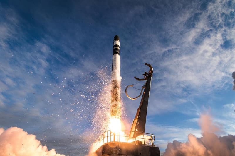
Countdown to liftoff
Targeting December 2026 — the exact date and time are not set yet. Launch dates firm up close to the attempt; set a free alert below to get the final time.
Launch time
- December 2026 — exact date and time not announced yet
This launch time is not yet confirmed. Rocket launches often slip by hours or days for weather, technical checks, or range scheduling; treat the time above as a target and re-check close to the date.
Free email alerts for HASTE | Leidos-3
A heads-up the day before, a reminder an hour out, Go-for-launch confirmation, and an email if the date moves.
Click the one confirmation email we send to activate. One-click unsubscribe.
Free email alert + a note if the date moves ✓ what you’re signing up for now
Pro a text when it’s a go and before liftoff (delivery times vary) · the weather at liftoff in the app · a minute-by-minute where-to-look plan · $19.99/yr or $4.99/mo
Free · no account needed
Sky outlook at the pad
Daily cloud cover and rain chance at Wallops Flight Facility, Virginia, USA (liftoff is still beyond the 7-day forecast window):
- Today
- Mon
- Tue
- Wed
- Thu
- Fri
- Sat
Forecast at the launch site; check your own sky too: cloud over you can hide a launch the pad forecast says is clear.
Pro members get an hour-of-liftoff go/no-go call (cloud, wind, rain chance and visibility) in the launch finder. Pro · $19.99/yr
Visibility map: how far away can you see it?
Each ring shows how far away Electron is line-of-sight visible that many seconds into flight: about 89 miles by T+30s, 192 miles by T+60s, and roughly 305 miles by T+90s. City dots are colored by the expected view quality; the table below has the direction to look from each.
Which cities can see this launch?
Estimated visibility from major towns near US launch sites, assuming clear skies and an open horizon. The 10 most likely first:
| City | Visibility | Look toward | Distance to pad |
|---|---|---|---|
| Wallops Island, VA | Excellent | west-southwest | 6 mi |
| Chincoteague, VA | Excellent | southwest | 9 mi |
| Onancock, VA | Excellent | east-northeast | 17 mi |
| Pocomoke City, MD | Excellent | south-southeast | 17 mi |
| Exmore, VA | Excellent | northeast | 28 mi |
| Berlin, MD | Excellent | south-southwest | 37 mi |
| Salisbury, MD | Excellent | south | 37 mi |
| Ocean City, MD | Excellent | south-southwest | 41 mi |
| Cape Charles, VA | Excellent | northeast | 49 mi |
| Rehoboth Beach, DE | Excellent | south-southwest | 65 mi |
Show all 94 cities
| City | Visibility | Look toward | Distance to pad |
|---|---|---|---|
| Virginia Beach, VA | Excellent | north-northeast | 73 mi |
| Newport News, VA | Excellent | northeast | 74 mi |
| Norfolk, VA | Excellent | north-northeast | 81 mi |
| Cape May, NJ | Excellent | south-southwest | 83 mi |
| Dover, DE | Excellent | south | 92 mi |
| Annapolis, MD | Good | southeast | 96 mi |
| Richmond, VA | Good | east-northeast | 109 mi |
| Ocean City, NJ | Excellent | south-southwest | 112 mi |
| Washington, DC | Good | southeast | 112 mi |
| Baltimore, MD | Good | south-southeast | 117 mi |
| Philadelphia, PA | Good | south | 147 mi |
| Myrtle Beach, SC | Marginal | north-northeast | 344 mi |
| Charleston, SC | Marginal | northeast | 430 mi |
| Hilton Head Island, SC | Not visible | — | 489 mi |
| Savannah, GA | Not visible | — | 508 mi |
| Brunswick, GA | Not visible | — | 574 mi |
| Jacksonville, FL | Not visible | — | 627 mi |
| St. Augustine, FL | Not visible | — | 642 mi |
| Valdosta, GA | Not visible | — | 657 mi |
| Palm Coast, FL | Not visible | — | 658 mi |
| Daytona Beach, FL | Not visible | — | 675 mi |
| New Smyrna Beach, FL | Not visible | — | 684 mi |
| Gainesville, FL | Not visible | — | 688 mi |
| Mims, FL | Not visible | — | 705 mi |
| Titusville, FL | Not visible | — | 707 mi |
| Sanford, FL | Not visible | — | 707 mi |
| Port Canaveral, FL | Not visible | — | 715 mi |
| Tallahassee, FL | Not visible | — | 716 mi |
| Merritt Island, FL | Not visible | — | 720 mi |
| Cocoa Beach, FL | Not visible | — | 721 mi |
| Rockledge, FL | Not visible | — | 722 mi |
| Orlando, FL | Not visible | — | 726 mi |
| Satellite Beach, FL | Not visible | — | 729 mi |
| Indialantic, FL | Not visible | — | 734 mi |
| Melbourne, FL | Not visible | — | 736 mi |
| Palm Bay, FL | Not visible | — | 739 mi |
| Kissimmee, FL | Not visible | — | 743 mi |
| Sebastian, FL | Not visible | — | 750 mi |
| Vero Beach, FL | Not visible | — | 760 mi |
| Fort Pierce, FL | Not visible | — | 770 mi |
| Lakeland, FL | Not visible | — | 773 mi |
| Port St. Lucie, FL | Not visible | — | 783 mi |
| Tampa, FL | Not visible | — | 793 mi |
| West Palm Beach, FL | Not visible | — | 813 mi |
| Pensacola Beach, FL | Not visible | — | 843 mi |
| Fort Lauderdale, FL | Not visible | — | 854 mi |
| Gulf Shores, AL | Not visible | — | 872 mi |
| Miami, FL | Not visible | — | 878 mi |
| Grand Isle, LA | Not visible | — | 1023 mi |
| Rockport, TX | Not visible | — | 1417 mi |
| Port Aransas, TX | Not visible | — | 1425 mi |
| Corpus Christi, TX | Not visible | — | 1444 mi |
| South Padre Island, TX | Not visible | — | 1502 mi |
| Port Isabel, TX | Not visible | — | 1505 mi |
| Laguna Vista, TX | Not visible | — | 1507 mi |
| Bayview, TX | Not visible | — | 1512 mi |
| Los Fresnos, TX | Not visible | — | 1518 mi |
| Harlingen, TX | Not visible | — | 1524 mi |
| Brownsville, TX | Not visible | — | 1526 mi |
| McAllen, TX | Not visible | — | 1550 mi |
| Laredo, TX | Not visible | — | 1562 mi |
| San Diego, CA | Not visible | — | 2357 mi |
| Mojave, CA | Not visible | — | 2360 mi |
| Pasadena, CA | Not visible | — | 2377 mi |
| Los Angeles, CA | Not visible | — | 2385 mi |
| Long Beach, CA | Not visible | — | 2389 mi |
| Bakersfield, CA | Not visible | — | 2399 mi |
| Malibu, CA | Not visible | — | 2410 mi |
| Fresno, CA | Not visible | — | 2412 mi |
| Thousand Oaks, CA | Not visible | — | 2415 mi |
| Oxnard, CA | Not visible | — | 2432 mi |
| Ventura, CA | Not visible | — | 2437 mi |
| Santa Barbara, CA | Not visible | — | 2456 mi |
| Solvang, CA | Not visible | — | 2475 mi |
| Buellton, CA | Not visible | — | 2478 mi |
| Los Alamos, CA | Not visible | — | 2479 mi |
| Santa Maria, CA | Not visible | — | 2484 mi |
| Orcutt, CA | Not visible | — | 2486 mi |
| San Luis Obispo, CA | Not visible | — | 2489 mi |
| Guadalupe, CA | Not visible | — | 2491 mi |
| Pismo Beach, CA | Not visible | — | 2491 mi |
| Vandenberg Village, CA | Not visible | — | 2491 mi |
| Lompoc, CA | Not visible | — | 2492 mi |
| San Jose, CA | Not visible | — | 2514 mi |
Where to look
A rocket lifts off below the horizon for distant viewers, then climbs into view as it gains altitude and flies downrange. Closer to the pad you'll see it within seconds; a few hundred miles away it can take three to six minutes to rise over the horizon. Find an open view in the direction shown for your city and start watching at liftoff.
Official launch details More from Rocket Lab ↗
Before you go
- Launch times change: scrubs and delays are common. Re-check the day of.
- Clear skies matter. Low cloud near the pad or along the trajectory can hide the rocket.
- Twilight launches are the most dramatic; daytime launches are the hardest to see at distance.
- Trajectory and timing here are estimates from a representative ascent profile.
HASTE Leidos-3 launch FAQ
When is the HASTE Leidos-3 launch date and time?
HASTE Leidos-3 is currently targeting December 2026 — the exact date and time have not been announced yet. Status: To Be Determined. Launch dates slip often; the countdown on this page tracks the latest target, or set a free alert to get the final time.
Where does HASTE Leidos-3 launch from?
From Wallops Flight Facility, Virginia, USA, operated by Rocket Lab. If you are within a few hundred miles, the city-by-city table on this page shows the expected view from your area and which direction to look.
How far away can you see the HASTE Leidos-3 launch?
Roughly 305 miles with clear skies: within about 89 miles of the pad the rocket clears the horizon in the first half-minute, and by T+90 seconds it is high enough to be line-of-sight visible around 305 miles away. Night launches can be visible even farther as the exhaust plume catches sunlight. The visibility map on this page shows the range rings and which cities fall inside them.
More upcoming launches
- Electron | We're Not Hawking Around (3x HawkEye 360) · In 2 days
- Electron | The Sea God Surveys (iQPS Launch 9) · In 2 weeks
- Electron | The Mountain God Rises (iQPS Launch 10) · In 3 weeks
- Electron | BlackSky Gen-3 6 · In 10 weeks
- Electron | BlackSky Gen-3 7 · In 10 weeks
- Electron | BlackSky Gen-3 8 · In 10 weeks
- Electron | BlackSky Gen-3 9 · In 10 weeks
- Electron | iQPS Launch 11 · In 10 weeks
Explore more
Launch data from TheSpaceDevs Launch Library 2. Page generated October 19, 2026.