Starship Flight 15 — launch date, time, visibility & where to look
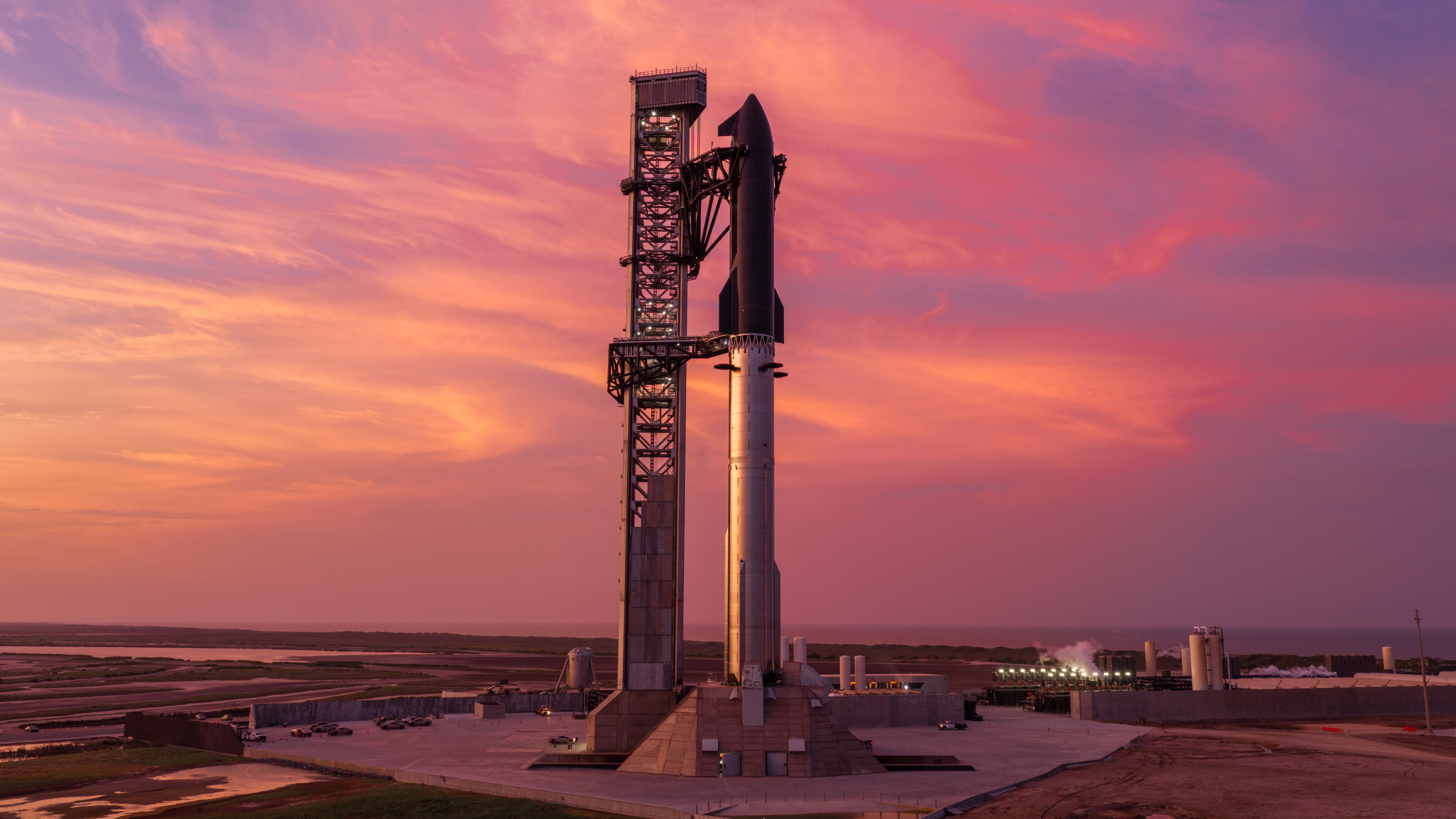
15th test flight of the two-stage Starship launch vehicle and 4th flight of Starship V3.
Countdown to liftoff
Targeting December 2026 — the exact date and time are not set yet. Launch dates firm up close to the attempt; set a free alert below to get the final time.
Launch time
- December 2026 — exact date and time not announced yet
This launch time is not yet confirmed. Rocket launches often slip by hours or days for weather, technical checks, or range scheduling; treat the time above as a target and re-check close to the date.
Get the exact time and direction for Starship | Flight 15: free email alert
Go-for-launch confirmation, a heads-up the day before, a reminder an hour out, and a note if the schedule slips.
We'll send one confirmation email from LookToSpace; click it to activate. One-click unsubscribe.
Free email alert + a note if the date moves ✓ what you’re signing up for now
Pro SMS launch reminders · significant schedule-change texts · exact compass bearing · $19.99/yr
Free · no account needed
Sky outlook at the pad
Daily cloud cover and rain chance at SpaceX Starbase, TX, USA (liftoff is still beyond the 7-day forecast window):
- Today
- Wed
- Thu
- Fri
- Sat
- Sun
- Mon
Forecast at the launch site; check your own sky too: cloud over you can hide a launch the pad forecast says is clear.
Pro members get the 7-day outlook for their own saved locations + a weather go/no-go call. Pro · $19.99/yr
Sonic boom expected
The booster returns to land at the launch-site catch tower — expect a sharp double sonic boom around the landing area a few minutes after liftoff. (Recovery plan not yet confirmed in launch data — recent flights have caught the booster back at the tower, so this assumes the same.)
The booster comes back for a catch at the tower around T+7 min; the boom then travels outward at the speed of sound: roughly a minute per 13 miles. Super Heavy is a far larger booster than a Falcon; its booms are louder and carry farther.
Likely heard in: Port Isabel, TX, South Padre Island, TX, Laguna Vista, TX, Bayview, TX, Los Fresnos, TX, Brownsville, TX · Possible: Harlingen, TX
Not an explosion: it’s the sharp double crack of a returning booster going supersonic. Starship sonic booms in South Texas, explained →
Pro members get boom alerts for their saved spots → Pro · $19.99/yr
Visibility map: how far away can you see it?
Each ring shows how far away Starship V3 is line-of-sight visible that many seconds into flight: about 89 miles by T+30s, 192 miles by T+60s, and roughly 305 miles by T+90s. City dots are colored by the expected view quality; the table below has the direction to look from each.
Which cities can see this launch?
Estimated visibility from major towns near US launch sites, assuming clear skies and an open horizon. The 10 most likely first:
| City | Visibility | Look toward | Distance to pad |
|---|---|---|---|
| Port Isabel, TX | Excellent | south-southeast | 6 mi |
| South Padre Island, TX | Excellent | south | 7 mi |
| Laguna Vista, TX | Excellent | southeast | 11 mi |
| Bayview, TX | Excellent | east-southeast | 18 mi |
| Los Fresnos, TX | Excellent | east-southeast | 21 mi |
| Brownsville, TX | Excellent | east-northeast | 22 mi |
| Harlingen, TX | Excellent | east-southeast | 36 mi |
| McAllen, TX | Excellent | east-southeast | 68 mi |
| Corpus Christi, TX | Good | south | 125 mi |
| Port Aransas, TX | Good | south | 127 mi |
Show all 94 cities
| City | Visibility | Look toward | Distance to pad |
|---|---|---|---|
| Rockport, TX | Good | south | 140 mi |
| Laredo, TX | Good | southeast | 179 mi |
| Grand Isle, LA | Fair | west-southwest | 492 mi |
| Gulf Shores, AL | Marginal | west-southwest | 647 mi |
| Pensacola Beach, FL | Marginal | west-southwest | 679 mi |
| Tallahassee, FL | Marginal | west-southwest | 841 mi |
| Tampa, FL | Fair | west | 914 mi |
| Gainesville, FL | Marginal | west-southwest | 940 mi |
| Lakeland, FL | Fair | west-southwest | 946 mi |
| Kissimmee, FL | Fair | west-southwest | 980 mi |
| Orlando, FL | Marginal | west-southwest | 984 mi |
| Jacksonville, FL | Marginal | west-southwest | 989 mi |
| Sanford, FL | Marginal | west-southwest | 993 mi |
| St. Augustine, FL | Marginal | west-southwest | 1003 mi |
| Palm Coast, FL | Marginal | west-southwest | 1005 mi |
| Daytona Beach, FL | Marginal | west-southwest | 1012 mi |
| New Smyrna Beach, FL | Marginal | west-southwest | 1015 mi |
| Mims, FL | Marginal | west-southwest | 1018 mi |
| Titusville, FL | Marginal | west-southwest | 1019 mi |
| Rockledge, FL | Fair | west-southwest | 1022 mi |
| Merritt Island, FL | Marginal | west-southwest | 1024 mi |
| Melbourne, FL | Fair | west-southwest | 1028 mi |
| Palm Bay, FL | Fair | west-southwest | 1029 mi |
| Port Canaveral, FL | Marginal | west-southwest | 1029 mi |
| Cocoa Beach, FL | Fair | west-southwest | 1029 mi |
| Satellite Beach, FL | Fair | west-southwest | 1029 mi |
| Indialantic, FL | Fair | west-southwest | 1031 mi |
| Sebastian, FL | Fair | west | 1035 mi |
| Vero Beach, FL | Fair | west | 1039 mi |
| Port St. Lucie, FL | Fair | west | 1040 mi |
| Fort Pierce, FL | Fair | west | 1043 mi |
| Miami, FL | Good | west | 1054 mi |
| Fort Lauderdale, FL | Fair | west | 1056 mi |
| West Palm Beach, FL | Fair | west | 1060 mi |
| Valdosta, GA | Not visible | — | 906 mi |
| Brunswick, GA | Not visible | — | 1014 mi |
| Savannah, GA | Not visible | — | 1056 mi |
| Hilton Head Island, SC | Not visible | — | 1078 mi |
| Charleston, SC | Not visible | — | 1136 mi |
| Myrtle Beach, SC | Not visible | — | 1215 mi |
| San Diego, CA | Not visible | — | 1288 mi |
| Long Beach, CA | Not visible | — | 1366 mi |
| Pasadena, CA | Not visible | — | 1372 mi |
| Los Angeles, CA | Not visible | — | 1375 mi |
| Mojave, CA | Not visible | — | 1394 mi |
| Malibu, CA | Not visible | — | 1399 mi |
| Richmond, VA | Not visible | — | 1402 mi |
| Thousand Oaks, CA | Not visible | — | 1410 mi |
| Oxnard, CA | Not visible | — | 1429 mi |
| Newport News, VA | Not visible | — | 1434 mi |
| Norfolk, VA | Not visible | — | 1436 mi |
| Ventura, CA | Not visible | — | 1437 mi |
| Bakersfield, CA | Not visible | — | 1447 mi |
| Virginia Beach, VA | Not visible | — | 1451 mi |
| Cape Charles, VA | Not visible | — | 1462 mi |
| Santa Barbara, CA | Not visible | — | 1462 mi |
| Washington, DC | Not visible | — | 1468 mi |
| Exmore, VA | Not visible | — | 1480 mi |
| Onancock, VA | Not visible | — | 1489 mi |
| Solvang, CA | Not visible | — | 1490 mi |
| Buellton, CA | Not visible | — | 1493 mi |
| Annapolis, MD | Not visible | — | 1496 mi |
| Los Alamos, CA | Not visible | — | 1500 mi |
| Baltimore, MD | Not visible | — | 1501 mi |
| Lompoc, CA | Not visible | — | 1508 mi |
| Pocomoke City, MD | Not visible | — | 1509 mi |
| Vandenberg Village, CA | Not visible | — | 1510 mi |
| Wallops Island, VA | Not visible | — | 1511 mi |
| Orcutt, CA | Not visible | — | 1511 mi |
| Santa Maria, CA | Not visible | — | 1513 mi |
| Chincoteague, VA | Not visible | — | 1514 mi |
| Salisbury, MD | Not visible | — | 1517 mi |
| Guadalupe, CA | Not visible | — | 1521 mi |
| Fresno, CA | Not visible | — | 1521 mi |
| Pismo Beach, CA | Not visible | — | 1528 mi |
| San Luis Obispo, CA | Not visible | — | 1532 mi |
| Berlin, MD | Not visible | — | 1534 mi |
| Ocean City, MD | Not visible | — | 1541 mi |
| Dover, DE | Not visible | — | 1547 mi |
| Rehoboth Beach, DE | Not visible | — | 1553 mi |
| Cape May, NJ | Not visible | — | 1568 mi |
| Philadelphia, PA | Not visible | — | 1590 mi |
| Ocean City, NJ | Not visible | — | 1596 mi |
| San Jose, CA | Not visible | — | 1645 mi |
Where to look
A rocket lifts off below the horizon for distant viewers, then climbs into view as it gains altitude and flies downrange. Closer to the pad you'll see it within seconds; a few hundred miles away it can take three to six minutes to rise over the horizon. Find an open view in the direction shown for your city and start watching at liftoff.
Before you go
- Launch times change: scrubs and delays are common. Re-check the day of.
- Clear skies matter. Low cloud near the pad or along the trajectory can hide the rocket.
- Twilight launches are the most dramatic; daytime launches are the hardest to see at distance.
- Trajectory and timing here are estimates from a representative ascent profile.
Starship Flight 15 launch FAQ
When is the Starship Flight 15 launch date and time?
Starship Flight 15 (often written Starship 15) is currently targeting December 2026 — the exact date and time have not been announced yet. Status: To Be Determined. Launch dates slip often; the countdown on this page tracks the latest target, or set a free alert to get the final time.
Where does Starship Flight 15 launch from?
From SpaceX Starbase, TX, USA, operated by SpaceX. If you are within a few hundred miles, the city-by-city table on this page shows the expected view from your area and which direction to look.
How far away can you see the Starship Flight 15 launch?
Roughly 305 miles with clear skies: within about 89 miles of the pad the rocket clears the horizon in the first half-minute, and by T+90 seconds it is high enough to be line-of-sight visible around 305 miles away. Night launches can be visible even farther as the exhaust plume catches sunlight. The visibility map on this page shows the range rings and which cities fall inside them.
More upcoming launches
- Starship | Starlink Group 31-1 (Starship Flight 14) · In 5 days
- Falcon 9 Block 5 | USSF-385 · In 3 days
- Falcon 9 Block 5 | Crew-13 · In 9 days
- Falcon 9 Block 5 | Transporter 18 (Dedicated SSO Rideshare) · In 9 days
- Falcon 9 Block 5 | Starlink Group 15-25 · In 3 weeks
- Falcon 9 Block 5 | Bandwagon 5 (Dedicated Mid-Inclination Rideshare) · In 5 weeks
- Falcon 9 Block 5 | Dragon CRS-2 SpX-35 · In 5 weeks
- Falcon 9 Block 5 | SDA Tranche 1 Transport Layer A · In 5 weeks
Explore more
Launch data from TheSpaceDevs Launch Library 2. Page generated September 23, 2026.